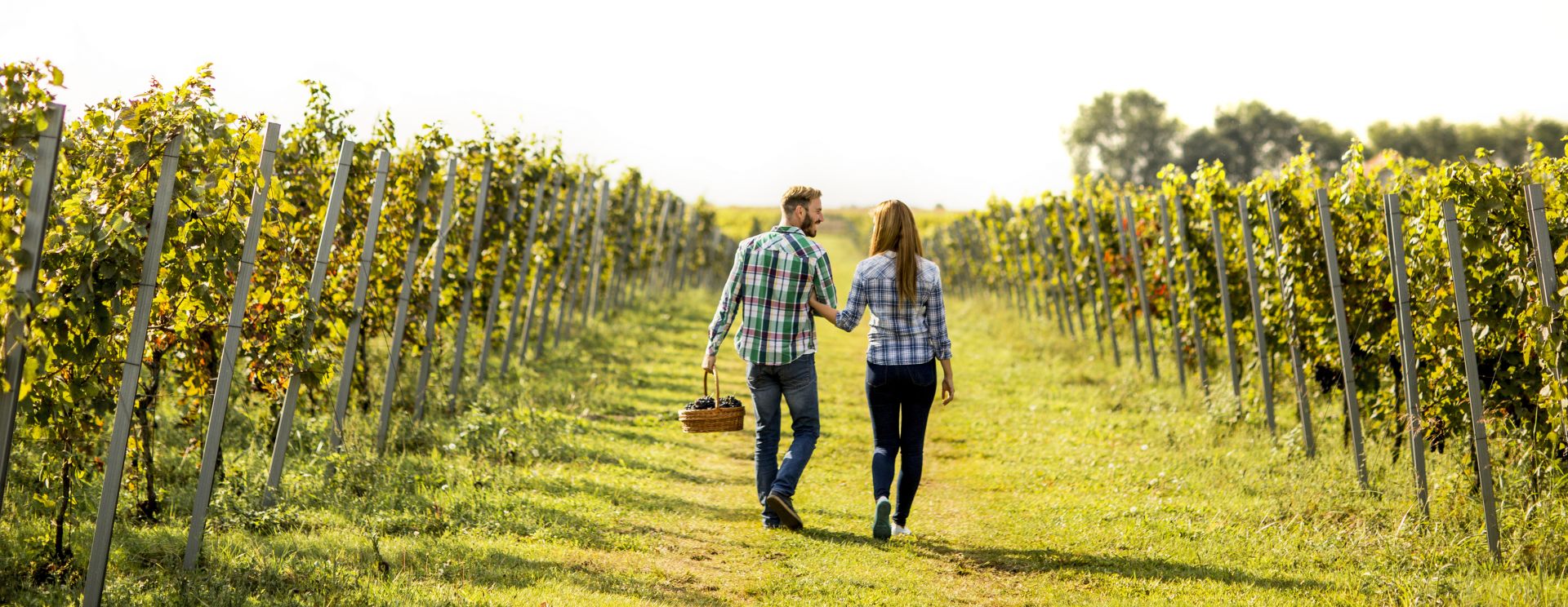
WALKING IN FUMANE
among vineyards and forests
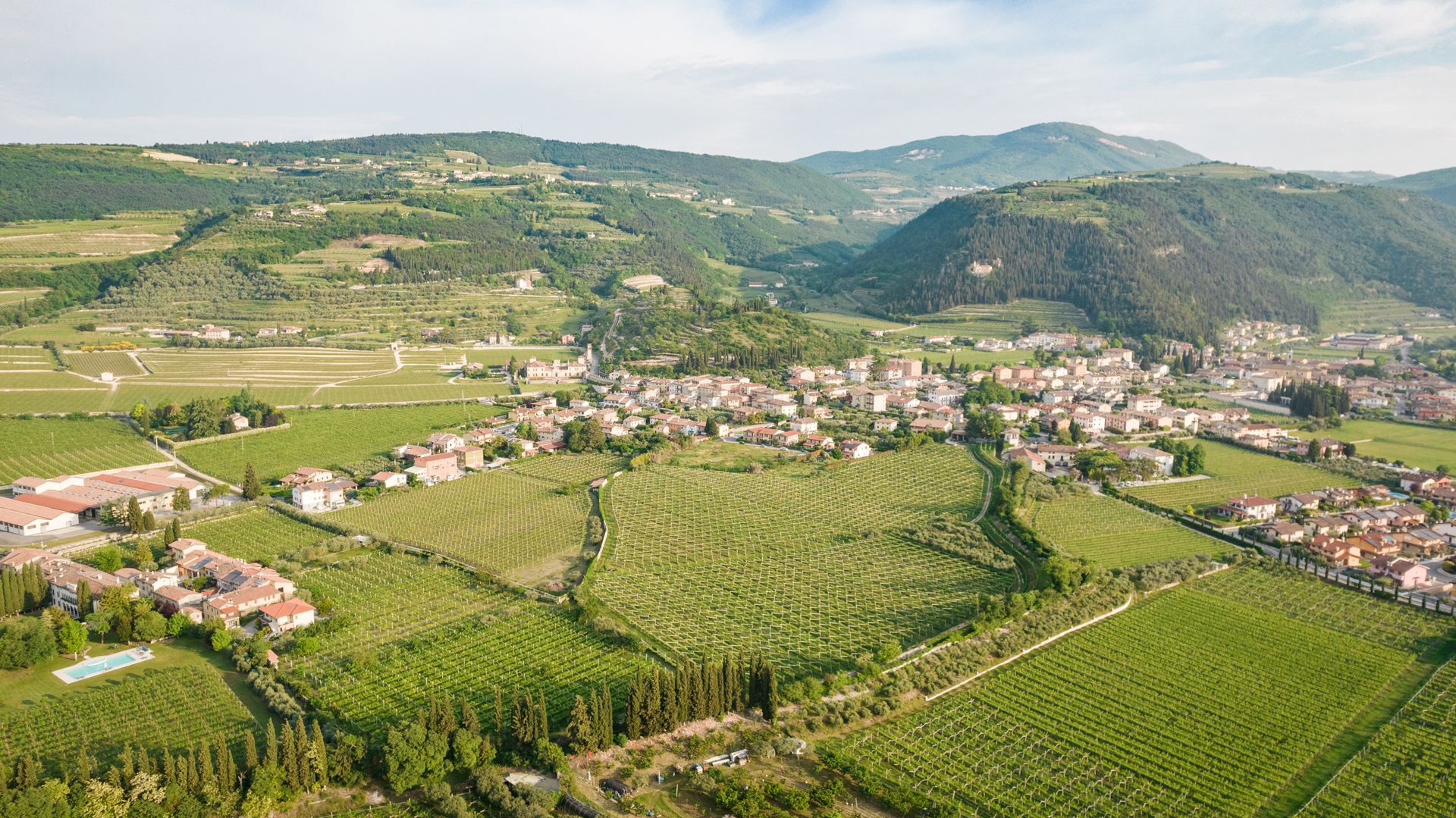
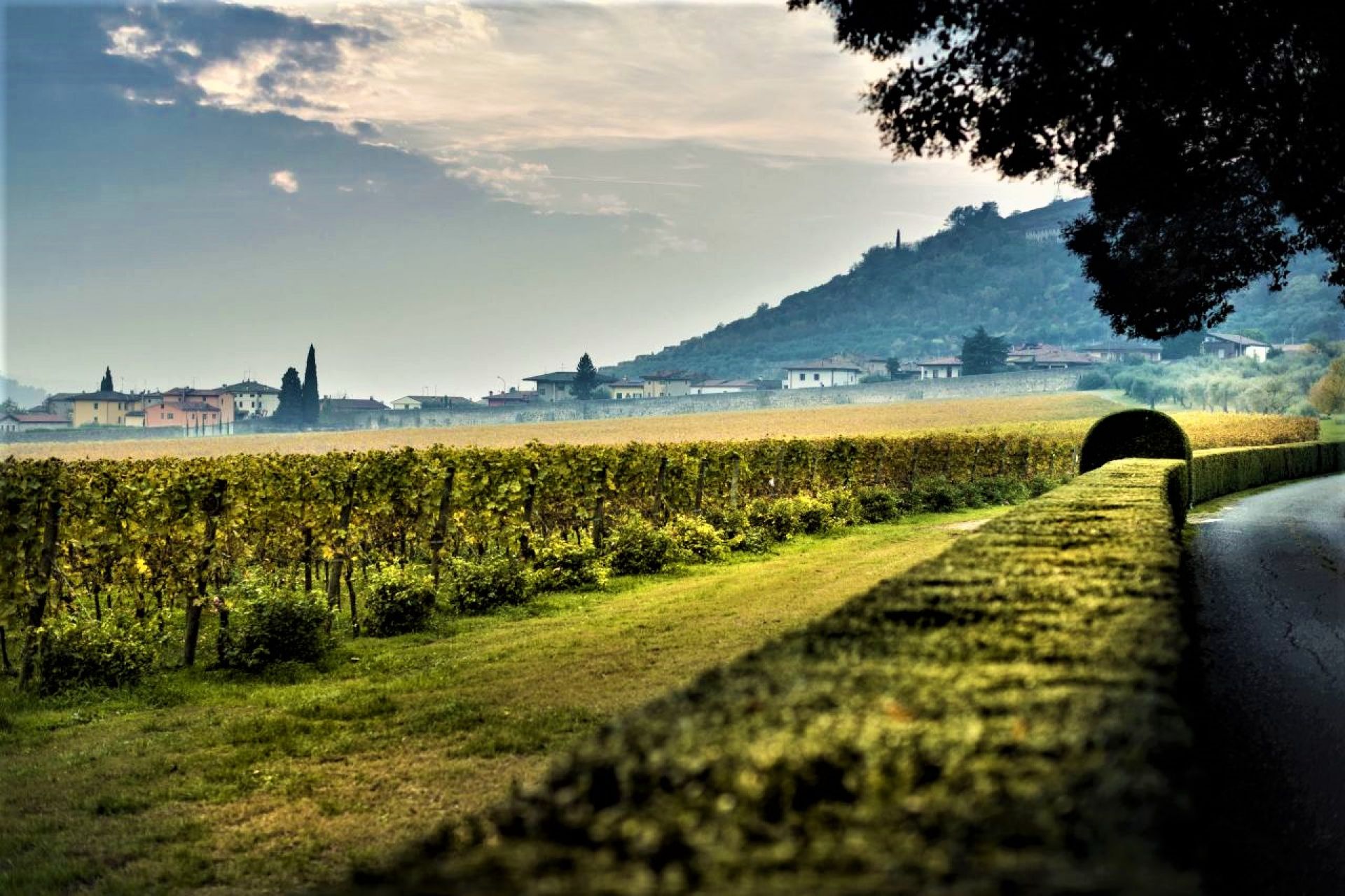
Scenic Fumane and Monte Sant’Urbano
This route is suitable for all. It starts out from the centre of Fumane, from the parish church of San Zeno Vescovo (point 1).
From here, go up Monte Sant’Urbano, the hill east of the village, and along a path flanked by vineyards. As you continue along the road, you’ll come to a scenic viewpoint (point 2) from which you can admire the whole valley, with the Fumane plain in the foreground, and look on towards the backdrop of the mountains to the north.
As you walk southwards along this scenic route, following the ridge of the mountain (point 3), visible to the north is the Shrine of the Madonna de La Salette: what makes this little chapel so unique is that it is perched on a rock spur in the middle of the woods.
At this point, head down through Casterna, one of the oldest neighbourhoods of Fumane, and walk back through the vineyards to the centre of Fumane, passing by the church of Santa Maria del Degnano (point 4). Inside the chapel is an interesting cycle of frescoes painted by Paolo Ligozzi in 1610.
History of Fumane: from San Micheletto to the La Salette Shrine
This easy route features some of the most interesting historical features in Fumane. Start out from the parish church (point 5) and walk through Banchette, one of the oldest neighbourhoods in Fumane. From here, walk up through the vineyards towards the hill to the west of the village, passing by the little mediaeval church of San Micheletto (point 6) and then the court with a dovecot in the Marega neighbourhood (point 7). After the courtyard, walk through a typical arch-shaped portico and along a country path that flanks an old boundary wall until you come close to the magnificent Villa Della Torre (point 8), one of the jewels in the crown of the Italian Renaissance. Cross Via Casa Rossa, just above the villa, take a path that goes around the Fumana hill, and head for the foot of the La Salette Shrine (point 9), which can be reached with a small detour up some steps in the woods embellished by Stations of the Cross. The fabulous position of the Shrine offers marvellous views over Fumane and the surrounding area. The route then heads back to the beginning, past the Neoclassical Villa Ravignani-Baietta (point 10) and through the old Ca’ Melchiori neighbourhood.
From Mazzurega to Monte Solane
This route, which is more challenging than the first two, starts out from the parish church of San Bartolomeo in Mazzurega (point 11). Leave the village behind and head southwards to the remains of Villa Lorenzi (point 12) in Cavarena di Sopra, the place of residence of the illustrious nineteenth-century abbot and poet Bartolomeo Lorenzi, which offers surprising wide-open views out towards the valley. From here, take north and walk up to the Madonna Addolorata Shrine on Monte Solane (point 13), and then continue on up along a path through the woods to the old Romanesque church of Cavalo (point 14). From here, make your way back into the woods and start your descent back down to the departure point, after a walk through the nearby Lorenzi Courtyard (point 15), one of the oldest residences with a portico and loggia in the Valpolicella.
From Breonio to Monte Pastelletto
This is a medium-difficulty route, which also offers breath-taking landscapes and views. It starts out from the centre of the village of Breonio, from the mediaeval church of San Marziale (point 20), decorated with fine sixteenth-century frescoes. Cross the centre of the village and head up to Monte Crocetta (point 21), the first of the scenic viewpoints along the route, with views stretching out towards the south of Lake Garda. Continue walking up until you reach the top of the nearby Monte Pastelletto (point 22), from where you can enjoy views on all sides over the surrounding area. Walk along the thick beech wood until you come to the neighbourhood of Paroletto (point 23), where you can admire an original fountain built into the ground and completely covered. Walk through a pine grove back to the departure point of the route.
From Cavalo to Monte Pastello
This nature trail has an elevation gain of around 570 m. It is the most challenging of the routes, and is suitable for fit, experienced walkers. It starts off from San Zeno Vescovo, the parish church of Cavalo (point 16). Walk through the centre of the village towards the west, and go up to the neighbourhood of Piazzi, where you can admire the village and the entire valley from a marvellous scenic viewpoint (point 18). Before heading up to the viewpoint, you can take a small detour from the centre of the village to an interesting covered fountain/washtub made from local stone (point 17). Continue along CAI path no. 238 to the neighbourhood of Molane, then take south-west and go up to the peak of Monte Pastello, (1112 m asl), where there is a two-metre-high stone cross (point 19). The fine local Rosso Ammonitico Veronese stone quarries have always been a distinctive feature of Monte Pastello. The incredible views from here are ample reward for the tough climb, taking in Monte Baldo, Lake Garda and the Adige Valley. To complete the route, walk back down along CAI path no. 232 to where you started off, in the centre of Cavalo.
Molina: a walk among the mills and Gorgusello
This moderate-difficulty route starts out from the centre of Molina, in the square in front of the parish church of Sant’Urbano (point 24). This neighbourhood is known for its mills, powered by the water found in abundance locally. As you start to walk up, you’ll encounter a few, including the renowned “Molin de Lorenso” (point 25), which still has the original external wheel. Continuing up northwards, you’ll come to the neighbourhood of Gorgusello (point 26), with some interesting old houses, courtyards and fountains built from Lessinia stone ashlars. Also interesting is the typical “baito di contrada”, a nineteenth-century construction that can be seen in many neighbourhoods of the Valpolicella and Lessinia area, where the locals once made cheese. To complete the route, walk back down to where you started. From here, you can continue towards the nearby Waterfall Park (point 27).
Extra
In addition to the various itineraries described, shown on the map are a number of points of interest worth visiting for lovers of history and nature. Along the Valle dei Progni, you’ll find the Valpolicella Park, which borders on the Municipality of Marano di Valpolicella, and offers a number of trails with a rich biodiversity, and the Grotta di Fumane, an archaeological site of international importance, the unique feature of which is that it contains traces of both Neanderthals and Homo Sapiens. Finally, between routes 4 and 5 is the interesting Masua Fort.
THANKS TO: Marco Dal Pozzo - CTG Genius Loci Valpolicella – Riccardo Pinamonte, Pro Loco tourist association of Molina, Pro Loco tourist association of Breonio, Fumane Guides Group.